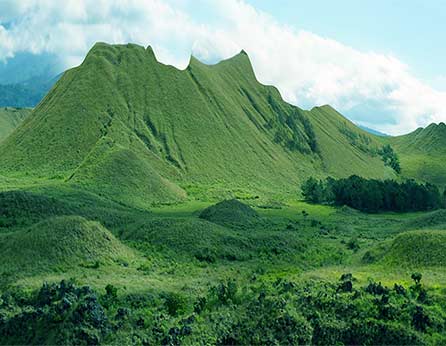
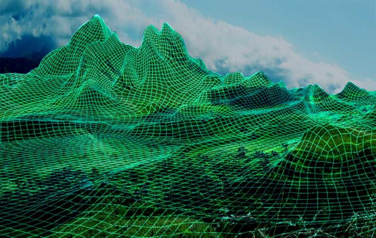
DTM is a three-dimensional image of the large land surface and analysis of terrain characteristics. The DTM contains information about the heights of a particular area without displaying objects and greenery. A digital elevation model (DEM) is created to visualize a local area with detailed landscape features (greenery, buildings, etc.). The processes of creating DTM and DEM are very similar. The DTM involves the analysis of a large (global) area of the earth’s surface, and the DEM provides a detailed analysis of the local land area.
Where is DTM Used
Construction works assess surface shapes, plan the building location, and efficiently use natural resources.
Modeling of roads, routes, and highways: analysis of the terrain, information on possible soil subsidence, and groundwater level.
Landscaping: information about the specific terrain features in a particular area, the location of slopes and hills, places of accumulation of water, and subsidence.
Tourism: analysis of fields of visibility when choosing the observation decks.
Engineering works are the design and installation of communication systems.
Research: information needed for research by geologists, ecologists, biologists, and geographers.
Cartography: compiling new and updating old maps, creating electronic maps and navigators.
Military and navigation: monitoring strategically essential territories, analysis of landscape changes, and specific region features.
Digital terrain models are created by processing spatial data, topographic maps, and satellite and space imagery. Drone aerial photography is the most efficient way as it does not require a lot of time and money, and the images are of high quality and detail.
How to create a digital terrain model?
Creating a digital terrain model includes a set of the following steps:
Preparatory stage: getting a product requirements document (PRD) from the customer, collecting information about the area and location of the land. The deadlines and costs are calculated.
To make the product requirements document, a customer should answer the following questions:
– What is the purpose of the digital terrain model?
– What is the area of the territory?
– What are the deadlines?
The answers to these questions will help you choose specialists and technicians to create a quality relief model.
It includes setting up a route for the drone, selecting the optimal points for takeoff and landing, and setting the coordinate system and altitudes.
Aerial photography of the area with the help of a drone involves obtaining spatial data about the terrain in high quality by a team of UAV pilots, cartographers, and surveyors. DEF-C has its production of the drone Observer and a fleet of UAVs of various types and configurations, which allows choosing the optimal technical equipment for creating the DTM without additional rent and costs.
Data processing is performed using special software. Images are systematized and “stitched” into one digital model with corrected errors.
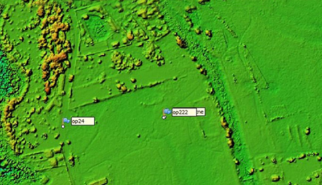
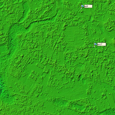
The digital terrain model is an image of the land’s land surface and high points. The DTM does not take into account greenery and constructed facilities. A digital elevation model (DEM) is developed for detailed local visualization.
It is possible to get such information With the help of DTM:
Graphic representation of the terrain with the help of horizontals, elevations, and symbols of various shapes (cliffs, rivers, dry areas, rocks, or glaciers).
Reciprocal position and the intersection of surfaces.
Quantitative characteristics of landforms at any model point: height, length, depth, area, volume, and angle.
Location and shape of slopes of hills, mountain ranges, and other relief elements concerning the prevailing wind direction.