Platform
IRIZI

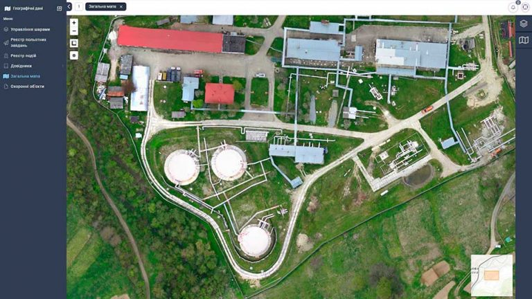
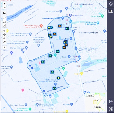
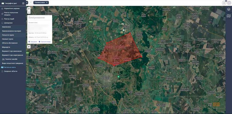
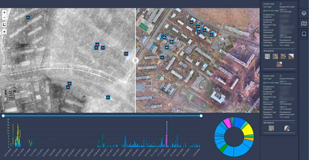
Geographic information system IRIZI

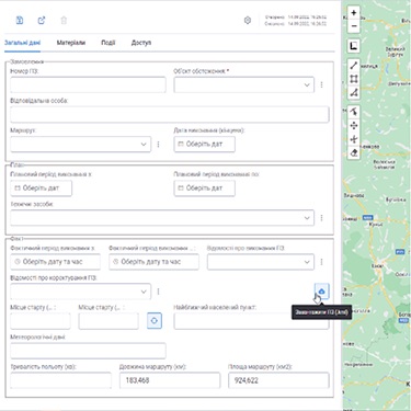
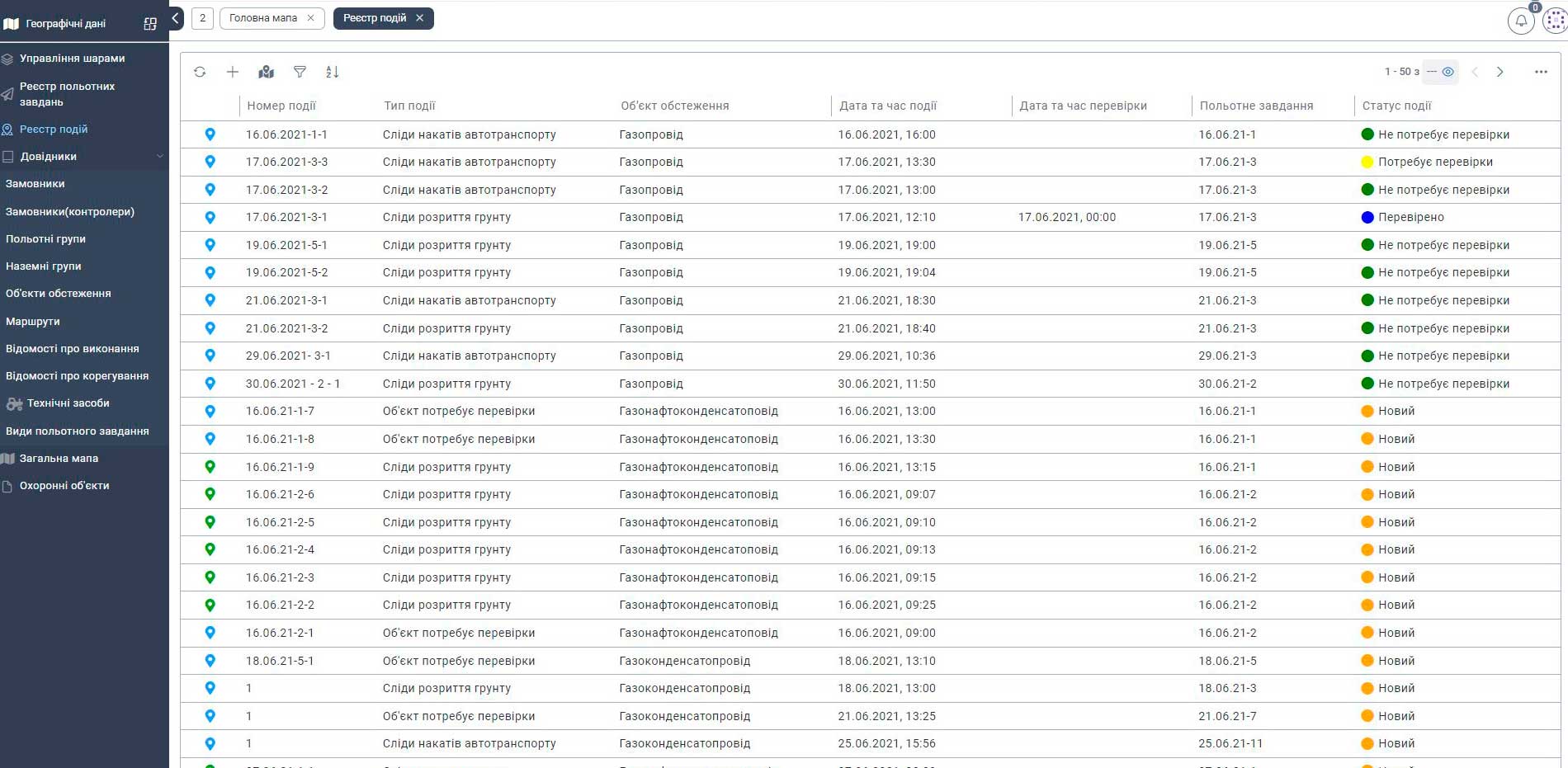
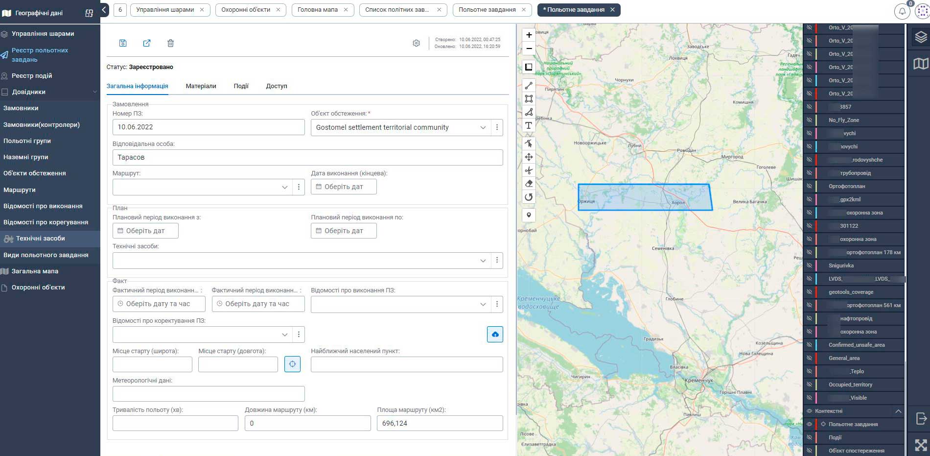
IRIZI is designed to provide planning and execution of tasks by flight groups for monitoring geographic objects (land plots, infrastructure objects, military targets) according to set goals. The results of tasks can be orthophoto plans of designated areas, detection of monitoring objects, events and incidents.

The system allows pilots to be grouped into flight teams, set tasks and control all stages of their execution.

The system can be easily integrated with existing GIS systems, management systems and document flows.

DEF-C is an official representative of IRIZI

Why IRIZI?

Scalability

Easy scaling for many users.
No additional software
installations needed.

Flexibility

Tools for building dialog forms.
Data checking tools.
Rapid data correction.

Ease of use

Unified user interface.
Data sorting and filtering
Intuitive navigation.

Fault tolerance

Continuous availability.
Seamless operation guarantee.
Data integrity is assured.

Web maps
creation

The IRIZI platform allows to create web maps, utilize ready-to-use resources, publish map services, conduct spatial analysis, and share data. 

The platform allows for easy access to maps from any device, making it a flexible and user-friendly tool for a variety of applications.

Building Geo Referenced Applications with mobile App

A mobile application of the IRIZI platform for smartphones that can work online and offline, where you can apply, store, edit information and perform GIS analytics

IRIZI platform can be used as a platform for building geographically-based applications. 

With its built-in map viewer, a gallery of basic maps is available to get started, as well as tools for adding your own data or layers. 

You can add shapefiles, spreadsheets, KML files, OGC WMS and WMTS services, cached mapping services, GeoRSS and GPS files, and easily combine data and cards provided by other users.

IRIZI Functional capabilities

• Register pilots and organize them into flight groups, manage and monitor their work performance;

• Allocate user access to data and system functions based on their assigned roles, permissions, and privileges;

• Upload and manage raster and vector layers, orthophoto plans, and manage access rights to them;

• Register survey objects and mark them on the map as vector layers;

• Manage a large number of flight groups by assigning them tasks and monitoring their performance;

• Establish a route for the UAV to fly within the framework of a specific task;

• Create ground-based tasks for incident and event checks that were identified during the execution of a particular flight task and monitor its completion;

• View system information in the form of diagrams and graphs using the Dashboard.

Platform IRIZI is designed for registering customers and performers, posting flight tasks, and uploading the results of their execution.

Business processes:

• Registration of a user in the System

• Authentication of the user

• Grouping users

• Adding/updating orthophoto

• Creating a flight mission

• Editing a flight mission

• Executing a flight mission

• Developing a flight mission

• Iincidents investigation

Single sign-on and
administration system

API integration with information resources

Unified interface
for accessing data

Access segregation and user action control

Do you want to order?

We will answer all your questions

Leave your details for more information and our specialists will contact you.