How to increase the efficiency of agribusiness? It is pretty easy to do this with the help of unmanned aerial vehicles. And here’s why – now drones are not only a tool for collecting spatial data but also a tool for a set of agrochemical measures for plant protection, drawing up accurate maps of areas, and determining the level of air pollution.
Advantages of using drones
– Speed. Walking surveys of fields or measuring areas with a tape measure is a complex and lengthy process, which, moreover, does not always give accurate results. And drones have a wide range of speeds, precise alignment, and high-quality cameras.
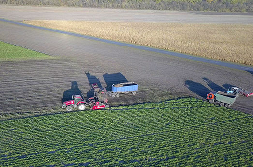
– Savings. UAVs minimize the amount of PPP (plant protection products) and water resources by spotting only the necessary areas. And regular monitoring reduces the risk of crop theft.
– Productivity. Drone inspection can be carried out on any day, regardless of weather conditions. It guarantees uninterrupted business operation, constant control of territories, timely elimination of incidents, and increases the number of sold products.
At what stage of the agricultural season should UAVs be used?
The answer is simple – at each stage of the growing season, drones will be helpful.
• Before sowing, you can use them to make up-to-date maps of terrain, altitudes, and orthophotos.
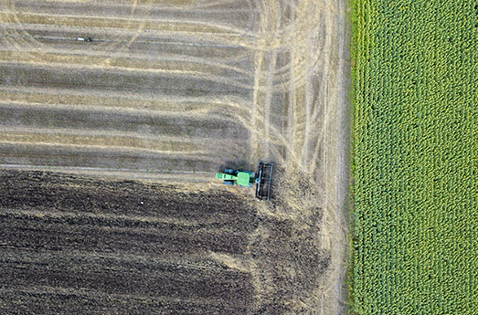
• In the middle of the season, aerial photography will reveal problem areas with low vegetation, weeds, or insect infestation. Its use will help distribute nutrient inputs and predict crop yields.
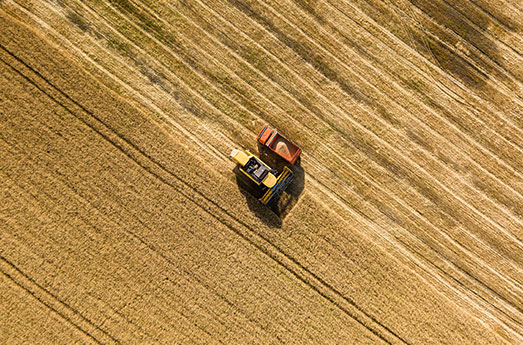
• At the final stage, drones can determine the areas from which it is better to start harvesting and optimize the work of farmers.
The introduction of unmanned systems is an effective solution to various problems. Therefore, the integration of UAVs into the agricultural sector will allow us to quickly and efficiently complete several tasks that would take farmers a lot of time and effort.
The complex of services from the DEF-C
The introduction of unmanned systems is an effective solution to various problems:
– Monitoring to assess soil condition, crop germination level, and area of affected areas (pests, weeds, diseases).
– Inventory and protection of crops. Regular inspection of areas will help calculate the expected amount of harvest and identify its illegal collection.
– Cartography of sites. Based on the drone aerial survey database, it is easy to compile new electronic maps with precise field boundaries, which often differ from those declared.
– Determination of NDVI using a multi-spectral camera. Knowledge of the normalized vegetation index will allow you to track plant development processes, identify areas with low vegetation and determine the optimal amount of fertilizers.
– Treatment of fields from the drone: application of plant protection products and Trichogramma of plant protection products and application of Trichogramma.
– Analysis of the ecological situation: air pollution, soil chemical composition, and relief defects.
DEF-C has its fleet of unmanned systems (aircraft and helicopter types) with different configurations. It allows you to solve any problem in the agricultural sector as efficiently and quickly.
UAVs quickly and efficiently explore large areas. They can collect the necessary data around the clock and transmit it to the control point in real-time.
monitoring of fields and crops, calculating the vegetation index and identifying problem areas, treating plants, and analyzing the level of pollution and humidity.