Inventory
of UTC lands

UAVs used for
the United
Territorial
Community (UTC)

Improving the living standards of the population and improving the work of local authorities are the priorities of each united territorial community (UTC). It is almost impossible to solve the issues of UTC without up-to-date information on the boundaries and operation of land holdings.

Periodic updating of cadastral registers has led to incorrect calculations of the square footage of plots and the availability of illegally used land. It affects the financial situation of both the OTC and the whole country.

We offer for UTC:

Aerial photography using UAVs is an operational way to obtain high-quality spatial data.

It is used for:

– Creating the digital terrain model, 3D model of terrain and surfaces of objects, construction of orthophotoplans.

– Monitoring the condition of facilities, stages of construction, and repair work.

– Determining the level of pollution of territories.

– Detection of illegal exploitation of land, water resources, and deforestation.

– Monitoring the condition of roads.

Land inventory is the collection and processing of data on land plots’ location, area, condition, and purpose.

Inventory and
Aerial
Photography
for UTC

Implementing LoGo and drone projects in land audits will reduce finances and optimize human resources, minimize time to obtain accurate data, and improve the living conditions of the entire UTC population.

Stages of inventory:

Aerial photography using UAVs

– Drawing up a topographic plan showing the boundaries of land plots, their size, and exact coordinates.

– Formation and approval of land management documentation.

Systematization of data using LoGo

LoGo (LOCAL GOVERNANCE) is a software that allows you to:

– Collect data about land and real estate.

– Control the local budget expenditures and tax payments.

– Open interaction with management, questions, and suggestions, voting for priority needs, and funding distribution.

– Convenient services for residents: service portal, register of clubs, tourist portal.

As a result, you get:

Technical documentation and geospatial database.

– Graphic materials: working and consolidated plans in paper and electronic form.

– Topographic plans at a scale of 1:2000 in paper and electronic form.

– Documentation of the results of land management in PDF format.

– Legal implication on the efficiency and appropriateness of land use.

– GIS is a system for operational data analysis and management decisions.

SUMMARY

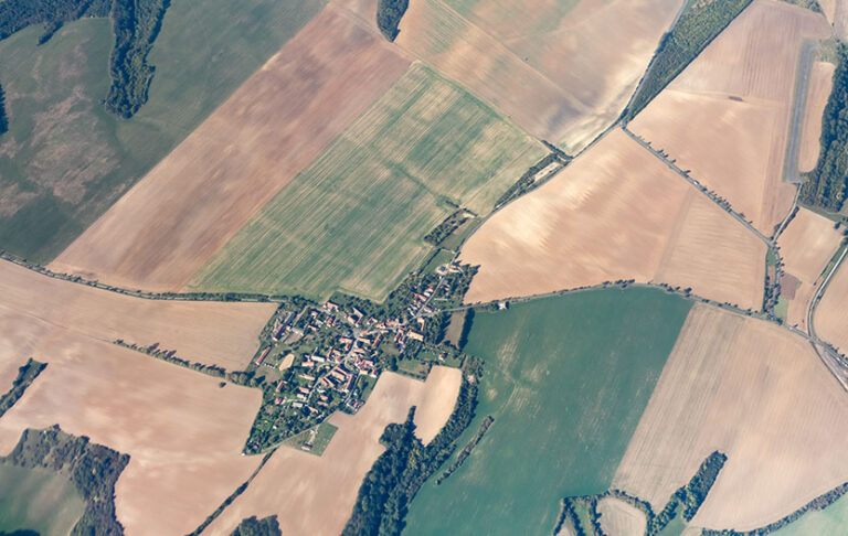
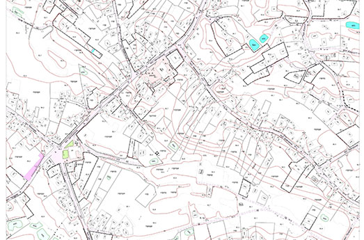
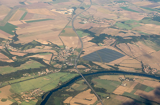
The main tasks of the United Territorial Community (UTC) are to optimize resources, account for land holdings, increase the local budget and improve the lives of the population.

They can be solved by collecting up-to-date data and land inventory using UAVs.

Effectiveness of LoGo projects implementation: increasing land tax revenues to the budget by 2-4 times within 1 year and the number of land plots taken into account by 3 times.

Rapid information collection, a compilation of new terrain maps, orthophoto- and topographic plans, elimination of problematic situations.

DEF-C offers UAV and LoGo software implementation services for data systematization, illegal land use elimination, budget expenditures control, and timely taxes payments

All fields

Do you want to order?

We will answer all your questions

Leave your details for more information and our specialists will contact you.